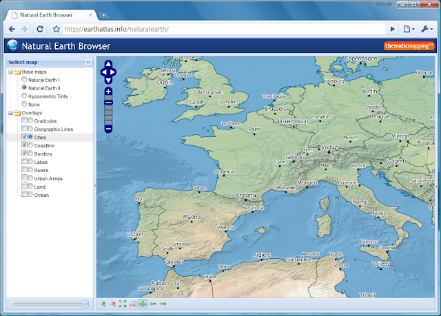
My holiday project, apart from skiing, was to play with the new Natural Earth dataset. This is a public domain map dataset available at three scales, 1:110m, 1:50m and 1:10m. By combing raster and vector data you can make a variety of visually pleasing maps. You can use my Natural Earth Browser to study the great linework of Natural Earth.

Natural Earth Browser consists of 13 map layers, 3 base maps and 10 overlays, which are shown in the original projection (Geographic, WGS84 datum). The map overlays are rendered as transparent map tiles. The layers can be reordered by drag-and-drop, and you can change the opacity of each layer with the slider control. Small scale data (1:110m) are shown for zoom level 1 and 2, medium scale data (1:50m) for zoom level 3 to 5, and large scale data (1:10m) for zoom level 6.
Natural Earth Browser was created with a variety of open source tools. Map tiles from raster data was created with MapTiler and optimised with pngng. Map tiles from vector data was styled with Mapnik and pre-genereated with TileCache. The map interface is based on OpenLayers, Ext JS and GeoExt.
The Natural Earth dataset is more than a collection of pretty lines. The vector data (shapefiles) are accompanied with attribute tables which can be used for styling and labeling purposes. I've just started digging into the styling capabilities of Mapnik, and I'm not realising the full potential of this toolkit. I had to spend some time skiing when natural earth looked like this:
