Together with Jon Olav Eikenes and Christan Løverås, I'm part of a new startup called Norviz. The main focus so far has been on projecting animated graphics onto physical landscape models. Our first job was to tell the history of the Telemark Canal, a beautiful waterway connecting the sea and the interior through eight locks at a distance of 105 km from Skien to Dalen in Norway.
The installation was made for West Telemark museum, and is now on show in Vrangfoss, the largest lock complex on the canal with five locks and a lift of 23 metres. The 3D model displays a 10 minutes map animation showing the history of the canal together with historical images, voice and sound effects.
Here are some of the technical details which might interest my readers :-)
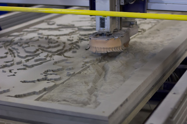
The digital elevation model was prepared in Blender and cutted with a a CNC router. It took the machine about 30 hours to finish the whole model.
Time-lapse of the cutting process:
After two coats of white paint, our model became a nice canvas for our map animation. Fun to see the geological structures from above.
The various maps telling the story of the canal was rendered with Mapnik before adding transitions and special effects in Adobe After Effects. With the help of three.js and some homemade scripts, we were able to align our map animation with the uneven landscape surface. Lastly we used JavaScript for Automation (JSX) to link and synchronise the the different parts of the installation.
See it live at Vrangfoss during summer season while the canal boats are operating!
Are you interested in collaborating with us or help us fill the world with engaging visualizations? Please don’t hesitate contacting us!
Map data from Kartverket.
Concept and story by Indici and West Telemark museum.
Photos above taken by Jon Olav Eikenes.
The installation was made for West Telemark museum, and is now on show in Vrangfoss, the largest lock complex on the canal with five locks and a lift of 23 metres. The 3D model displays a 10 minutes map animation showing the history of the canal together with historical images, voice and sound effects.
Here are some of the technical details which might interest my readers :-)
The digital elevation model was prepared in Blender and cutted with a a CNC router. It took the machine about 30 hours to finish the whole model.
 |
| Cutting a large 240x110 cm model of the Telemark Canal in Valchromat. |
After two coats of white paint, our model became a nice canvas for our map animation. Fun to see the geological structures from above.
 |
| Setup and calibration in an old barn at Vrangfoss. The video projector was mounted 4 meters above the model. |
 |
| The final installation showing graphics projected on the physical landscape model. |
 |
| From Varden newspaper 28 June 2016. |
See it live at Vrangfoss during summer season while the canal boats are operating!
Are you interested in collaborating with us or help us fill the world with engaging visualizations? Please don’t hesitate contacting us!
Map data from Kartverket.
Concept and story by Indici and West Telemark museum.
Photos above taken by Jon Olav Eikenes.
